
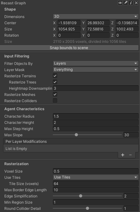
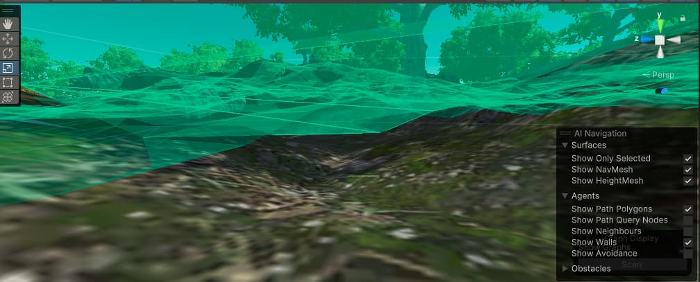
I have uneven mountainous terrain. In the valleys and smaller depressions, the graph mesh is floating above the terrain.
This is expected. The navmesh does not care that much about the Y coordinate. It’s ok as long as it is somewhat close to the actual terrain. It looks totally fine in your example.
If it becomes an issue, you can reduce the Tile Size to make it fit better with the terrain.
Thank you for the clarification